Living in Orange County, CA.
“Pursuing Balance Through Adventure” is about finding one’s self by freeing the soul through bold experiences in nature and exploring that delicate balance between responsibility and wild abandonment.
8 miles, 5074’ elevation, 3293’ elevation gain, 5 hour duration, rated HARD
Date: 3-25-21
Do not take this hike lightly it is a long, hard hike, but it is a scenic hike with a well maintained trail. That being said, it is not easy to find the trailhead so AllTrails GPS is helpful to get started. The trail begins with a flat section before it reaches the foothill and then sturdy hiking footwear is advised as sections of the trail are steep and rocky.
I did this hike in early Spring, but if you do it in the Summer bring plenty of water, snacks, and leave early because it is a mostly exposed trek and will get hot.
What you can expect is steep narrow single track etched into the side of the mountain. Loose rock and slippery dirt leads to the suggesting for good boots, and trekking poles if you have them, as one could easily turn and ankle. Only folks I saw were two guys making up a trail crew. They had done a nice job, as the mountain vegetation and erosion is constantly trying to reclaim it.
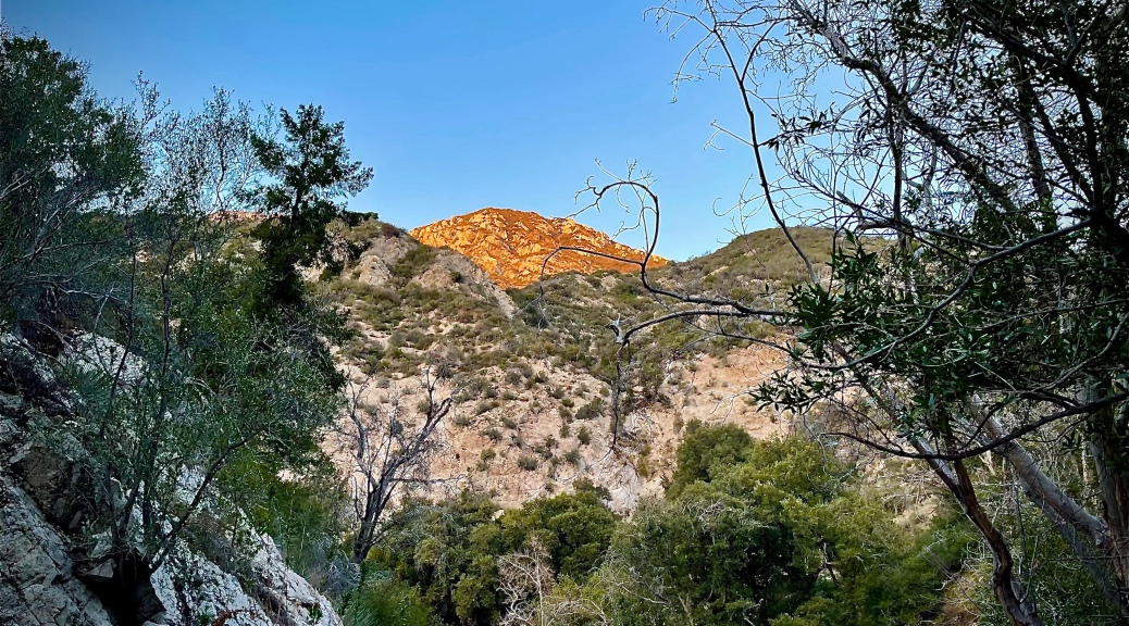
The mountain’s summit is nothing to look at but communication towers. Moody clouds were about so views were more limited then they otherwise would have been towards civilization, but the nice views mostly over the mountain range inland will definitely delight you.
The hike begins relatively flat, but it isn’t long where that all changes.
“Everything worthwhile is uphill. Everything.” John Maxwell
Thanks for joining me on my trek ‘Pursuing Balance Through Adventure’ in the Angele’s National Forest atop Mt Lukens. I took the longer, more rugged, and more scenic route… worth it! I invite you to travel with me again by taking these steps: LIKE, COMMENT, FOLLOW and SHARE. Visit the menu above for other locations that PBTA explores. They are all separate websites and thus need to be FOLLOWED independently. Checkout my shirt, face buff, and hat. They are top quality, carry the mantra, and are available at SHOP APPAREL.
8 miles, 2,516’ elevation gain, duration > 6 hours, rated HARD
Date: 3-19-21
Starting at Redbox Picnic area it was a short distance before I made the trail. At first I was looking at going straight up a steep snow filled gully, but it wasn’t long before I hit the actual trail. There is a series of switchbacks going through a lovely oak grove with beautiful peek-a-boo mountain view’s.
There was snow covering the trail in some spots. The snow wasn’t icy it was more like a snow cone texture. With good boots and trekking poles I made it without too much problem. I will admit there was a couple of times, on particularly sketchy spots, that I probably should have put on micro spikes. I was just very careful instead, as it was a just a short distance.
The only disappointment hiking Mount Disappointment was that the oak grove portion of the hike wasn’t longer. Also the section that was service road was not the nature I was seeking nor were the communication towers or the construction going on, but the views were nice.
Next up was San Gabriel Peak which was the tallest. The climb increased in difficulty as you went. You have to backtrack off of each of these peaks. The trail between the first two peaks and the last is about a foot wide and is etched into the mountain. Be mindful of your step as it is a long ways down in most areas. Shaded areas still had snow making your journey all the more hazardous.
The third assent was Mount Lowe and it just so happens it is indeed the lowest. For being the lowest it was the one with the most attention. It had a summit sign, signage talking about yesteryear and a railway. There were spotter scopes to point out the neighboring peaks, and a first for me, a swing set. So you can really be ‘Pursuing Balance Through Adventure’ as your soar back and forth with fabulous views of the City of Angels as well as the mountains both near and far.
The final climb of the day was the toughest Mount Markham. It has you maneuvering through over grown sticker bushes as you make your way up a rocky spine with a serious drop off to one side and steep terrain to the other. At the high point there is a power circle. I am assuming this has something to do with Native Americans as there is a cultural center of sorts at Redbox. If you hike just beyond that you will come to the end of the trail with a great view of the prominence between where you stand and San Gabriel Peak also down below you can see the tunnel that comes up from Eaton Saddle, a shorter entrance to this hike, but then you would miss the wonderful hike up through the oak grove.
Compare these stats with the ones I posted at the top of this article. The difference was being forced to hike from Red Box Picnic Area due to a closure. The detour was totally worth it because I loved hiking through the snowy oak grove.
If you think you’ve peaked, find a new mountain.On the summit of Mt Markham with San Gabriel Peak in the background. These mountains should not be underestimated a woman hiker had died in this area the week before. Soon after this pic was taken I slipped on a dusty steep spot, and slid into a cactus slightly twisting my ankle. Luckily I was able to walked it off. Like Patton Manning said just rub some dirt on it you’ll be fine.
Thank you so much for joining me as I found myself ‘Pursuing Balance Through Adventure’ on not only one peak but four! Such a fun hike, such a fun adventure, such a wonderful way to get some balance from the mundane, but necessary aspects of life. When you are out getting close to nature you are one with the universe. Exercise, fresh air, views, adventure… so good! Be with me for the next adventure by simply doing this COMMENT, LIKE, FOLLOW and SHARE. Check out more adventures and places to put on your list by going to the menu above. Keep in mind that each location is a separate website and thus needs to be FOLLOWED independently. Stop by SHOP APPARELfor all of your adventure wear needs. What a great way to live the message, ‘Pursing Balance Through Adventure’.
8.7 miles, 1,906’ elevation gain, 4.5 hour duration, rated Moderate
Date: 2-4-21
I think if you are a SoCal resident that likes to hike, or a tourist that wants bragging rights then what has to be one of the most famous signs in the world should be on your hiking list. I know it was on mine ever since I heard there was such a thing, and I am one of those who would really rather be out lost in nature than hiking in a park that is smack dap in the center of one of the largest cities in the world. But I have to tell you I was pleasantly surprised with not only how cool this hike was, but how cool Griffith Park is.
I set out quite early on a Winter Tuesday which I am sure provides a much different experience than a midday Summer Saturday. There are certainly different hikes one could take including a much shorter version starting around the Griffith Observatory, but I wanted to see as much of Griffith Park as I could and wanted some exercise. I will also mention that my hike was longer and with more elevation then is listed on the attached map and hike description, but there were LA Peaks to bag and sights to see. I wanted to see the icon Hollywood Sign from as many vantage points as possible. My personal tracker had me at 12 miles, 6.5 hours.
I had only been to Griffith Park once and that was a very long time ago, and I really just pulled into the parking lot and though, “hmmm… I should check this out someday.” Well, now I wonder why I waited so long!
This day’s hike started near the carousel and what put a grin on my face was it wasn’t long before I was on a pretty steep little trail that was rugged and filled with vegetation. Griffith Park has rolling hills and dare I say little mountains? There were plenty of big broad park trails that I would meander along during my hike, but I was pleased to opt on some smaller single track trails as well, providing much more nature and a little more adventure then I was expecting.
During my day I summited multiple little LA peaks: Mt Chapel, Mt Lee, Taco Peak, Mt Bell, (and yes if you hike those two consecutively you come up with Taco Bell), Mt Hollywood and Glendale Peak. I added on vistas as well, including what was called the Best View of the Hollywood Sign. This spot was from down below the sign, near the Tyrolean Tank, just above some Hollywood Hills neighborhoods.
Near the end of my outing I had become complacent following the big broad park trail just figuring this would loop around and return me to my starting point. When I finally checked I realized that Griffith Park is a pretty big park and there was more than just the front entrance to access it. So I was off course… Well, I could back track or go off road on an excursion and you can guess which option I chose. I found a delightful little trail that made it’s way downhill through a thicket of lovely trees and brush. It was just the way to end a fun adventure “Walking in LA”, and contrary to the 80’s Band ‘Missing Persons’ song verse some people do indeed Walk in LA.
Pursuing Balance Through Adventure YouTube Channel
This trail map was just a starting point for me as there were peaks to bag and sights to see.
How about that a Wilderness area smack dap in the middle of one of the largest cities in the world.
One of the multiple LA peaks I bagged this day. This gratuitous summit selfie shot is from Mt. Chapel. The radio tower on Mt Lee to my left.
Mt. Lee crammed with communication towers, but also home to the Iconic Hollywood Sign.
Close Up of Griffith ObservatoryCity of AngelesA fun interesting back trail that I took to get back on track when I had gone too far on the broad tail.
“Everywhere is walking distance if you have the time.” – Steven Wright
Thanks for joining me Walking in LA, an adventure to the Hollywood Sign in what turned out to be a pretty cool place, Griffith Park with wonderful views of Tenseltown, and Los Angeles. For more adventures please stay tuned: FOLLOW, COMMENT, LIKE and SHARE. Find your adventure by getting ideas in the menu above. Each location is a separate website and thus needs to be followed independently. Stock up with adventure wear at SHOP APPAREL.
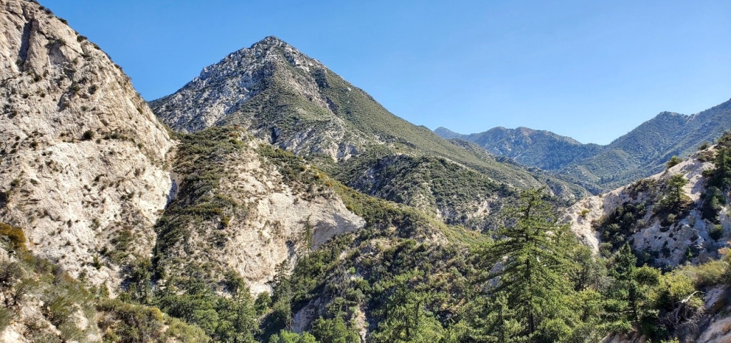
This hike nestled in the front portion of the San Gabriel Mountains is a moderate cruiser type of hike which has a good amount of elevation gain, but on double track dirt utility road. There are nice views along the way and on top it was superb. The Santa Ana’s were blowing, changing a Winter’s day to a day with bright blue clear skies and mild temperatures with sweet views of not only downtown LA, but beyond to Catalina Island. In the opposite direction mountain upon mountains. I enjoyed the visual of neighboring Strawberry Peak as well as Mount Wilson, both of which I have climbed previously.
On the top, besides the communication tower, were the remnants of a Fire Lookout that was lost long ago to wildfires that ravage the area. I always prefer single track trails to broad dirt roads, so off of the top I tried following a trail, but was soon turned away due to an overgrowth of yucca and other thorny vegetation that bites.
This hike has wonderful visual delights in all directions, and is an excellent vantage point to survey the uniqueness of Strawberry Peak, which has the unusual shape of a topsy-turvy strawberry.
Double Track utility road heading up to the communication tower atop Josephine Peak.
‘Pursing Balance Through Adventure’ YouTube Channel I need a time out. Send me to the mountains and don’t let me come back until my attitude changes.
Josephine Peak Trail fills you with sweeping vistas of LA, Westwood, Pasadena, Catalina, and the San Gabriels to include nearby Strawberry Peak, Mt Lawlor, and Mt Wilson. Thanks to the clearing Santa Ana winds I enjoyed Spring like temperature on a Winter’s Day. How is that for ‘Pursing Balance Through Adventure?’ For more, oh so much more than LIKE, COMMENT, FOLLOW and SHARE. Where can you get such a great looking embroidered cap as the one I have on in the picture you might ask. Well thanks for asking, simply go to SHOP APPARELwhere you will find marvelous adventure wear. If you go to the menu above you will see that ‘Pursing Balance Through Adventure travels the West in search of transformation that can help you gain a more centered existence. We are all dealing with the pressures of a crazy chaotic world. Bold outings in Nature can help silence that noise. Too much one way or the other can less than advantageous. It is a fine line that we seek between responsibility and wild abandonment. Let Nature be your guide. Go boldly into the Great Outdoors. Each menu location has a separate website and thus needs to be FOLLOWED independently.
8.5 miles, (10.5 If you add “THE HOUSE!!!”), 1550’+ elevation change, rated Moderate
Date: 2-24-21
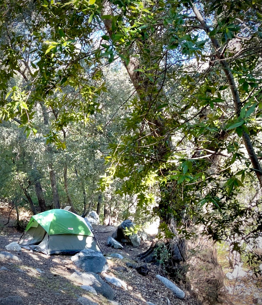
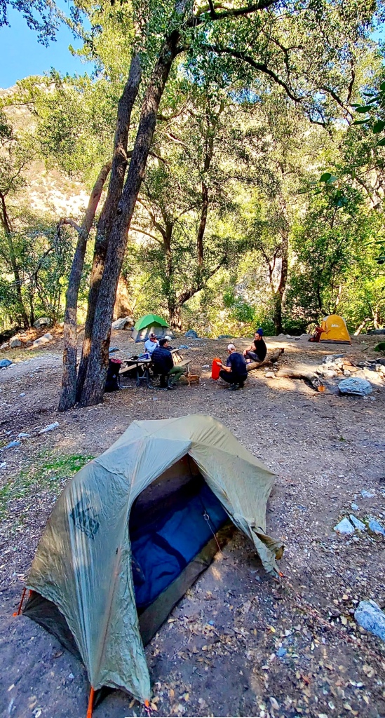
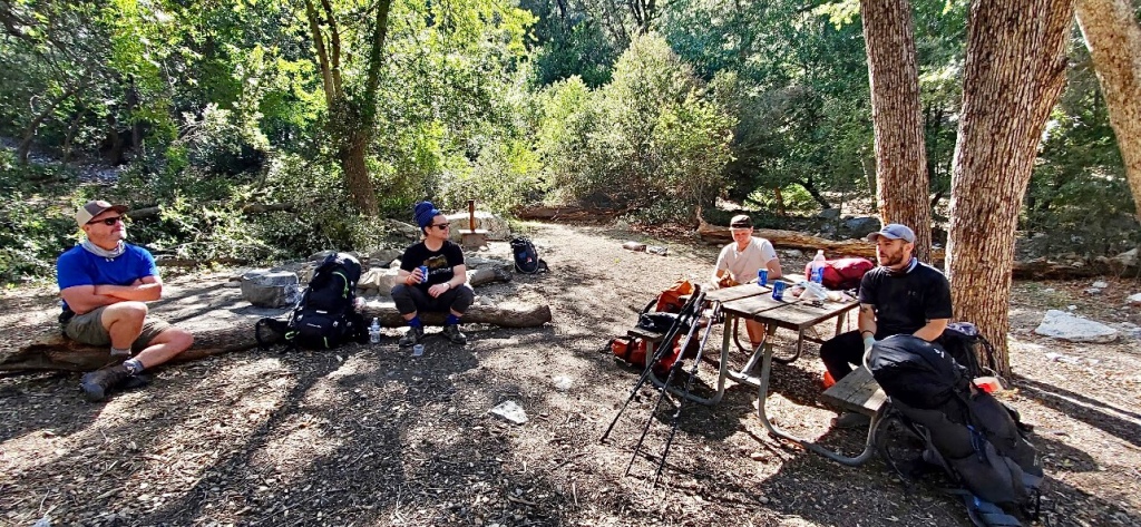
It was great to be in a backpacking tent again. I joined some new LA backpacking friends all ‘Pursuing Balance Through Adventure’ in the Angeles National Forest. These friends were checking gear for the start of their Epic Through Hike journeys starting in the next couple weeks. Anthony and Grant will be backpacking 770 miles of the Grand Enchantment Trial through Arizona and New Mexico. Ahmed will be tackling the Pacific Crest Trail over 2,500 miles from Mexico to Canada. That left Joey and myself without such a grant adventure, but along for the ride on this trip, and grateful to be out in nature just the same.
Especially since most of my adventures are solo it was really cool to be sharing the trek with these Trail Blazers, cracking jokes, spinning yarns, comparing adventures, learning new techniques, talking about places to explore around the campfire.
We gathered at the trailhead and set off- the Butcher, the Baker, and the Candle Stick Maker. Actually it was the out of work, but certainly not the depressed or downtrodden because we have such a love for nature, adventure and the pursuit thereof. The Architect, the Music Industry Sound Engineer, Hospitality Providers, and the Adventure Blogger hit the trail.
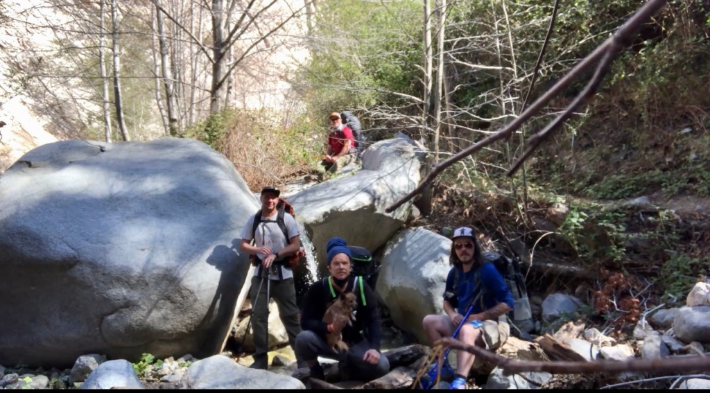
The first stop was Switzer Falls to enjoy the waterworks and a snack of Clif bars and fruit. This was my second trip to the falls. It is a popular and wonderful hike and I invite you to look back at my previous post: Switzer Falls via the Gabrielino Trail from 1 year ago almost to the day.
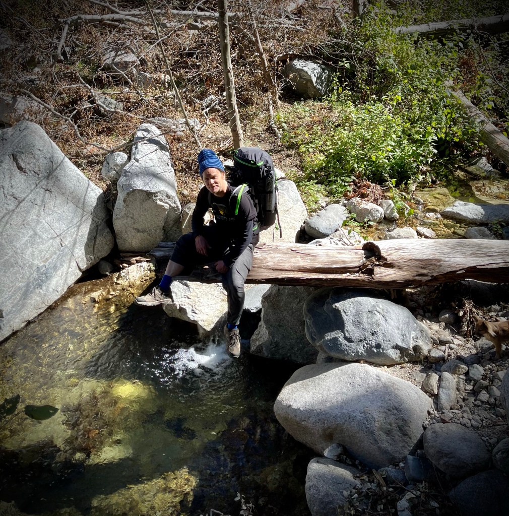
After we snapped a few photos we sat our sights on Bear Camp. The journey through the rugged canyon took us along a couple of spots not for the squeamish or those with fear of heights as the trail was narrow and the fall was wide. There were incredible views of the surrounding mountains, hills, and the canyon, filled with trees, and stream crossing were plentiful. Some rock hopping, and log crossing all added to the fun and excitement.
We arrived at Bear Camp at lunch time. What a great trail camp! Next to a stream, mountain and canyon views, tree canopy for shade, it even had a picnic table and fire ring, Shangri-La, (Definition: a place regarded as an earthly paradise, especially when involving a retreat from the pressures of modern civilization. BINGO!! Also known as “Pursuing Balance Through Adventure’), to be sure. We set up our tents and then struck out on an otherworldly type of adventure.
Camping is a great time for ghost stories around the campfire, but we said screw that let’s go experience one! You see Joey had something in mind and he wet our appetite for it recanting his macabre encounter just a few weeks earlier in these very woods. With raised eyebrows we set out to investigate the shuddersome goings on at “THE HOUSE!!!”
We returned from our menacing, strange escapade just before dark with our hunger for ghost stories satisfied, but not our actual appetite. We all chowed on some type of freeze dried meals each of us interested in what the other had from Thai to Mexican, Italian and who knows what else.
We had the best campfire ever between Joey‘s gathering just the right fallen limbs, and Grant’s teepee stacking, to Anthony’s secret fire starter wad. The night had a chill and the fire felt warm and delightful before turning in for a long night of cat napping and listening to Grant getting plenty of shut eye, for his tent was only 10 yards away.
There was a wind event late that night which was a little unnerving as there was a freshly fallen tree in the camp which took out the tree next to it as well. Still we were somewhat protected being down in the Canyon, but we certainly could hear the rush of the wind almost like a plane engine along the tops of the canyon. Even this roar could not drown out Grant. I am just kidding Grant, sorta…
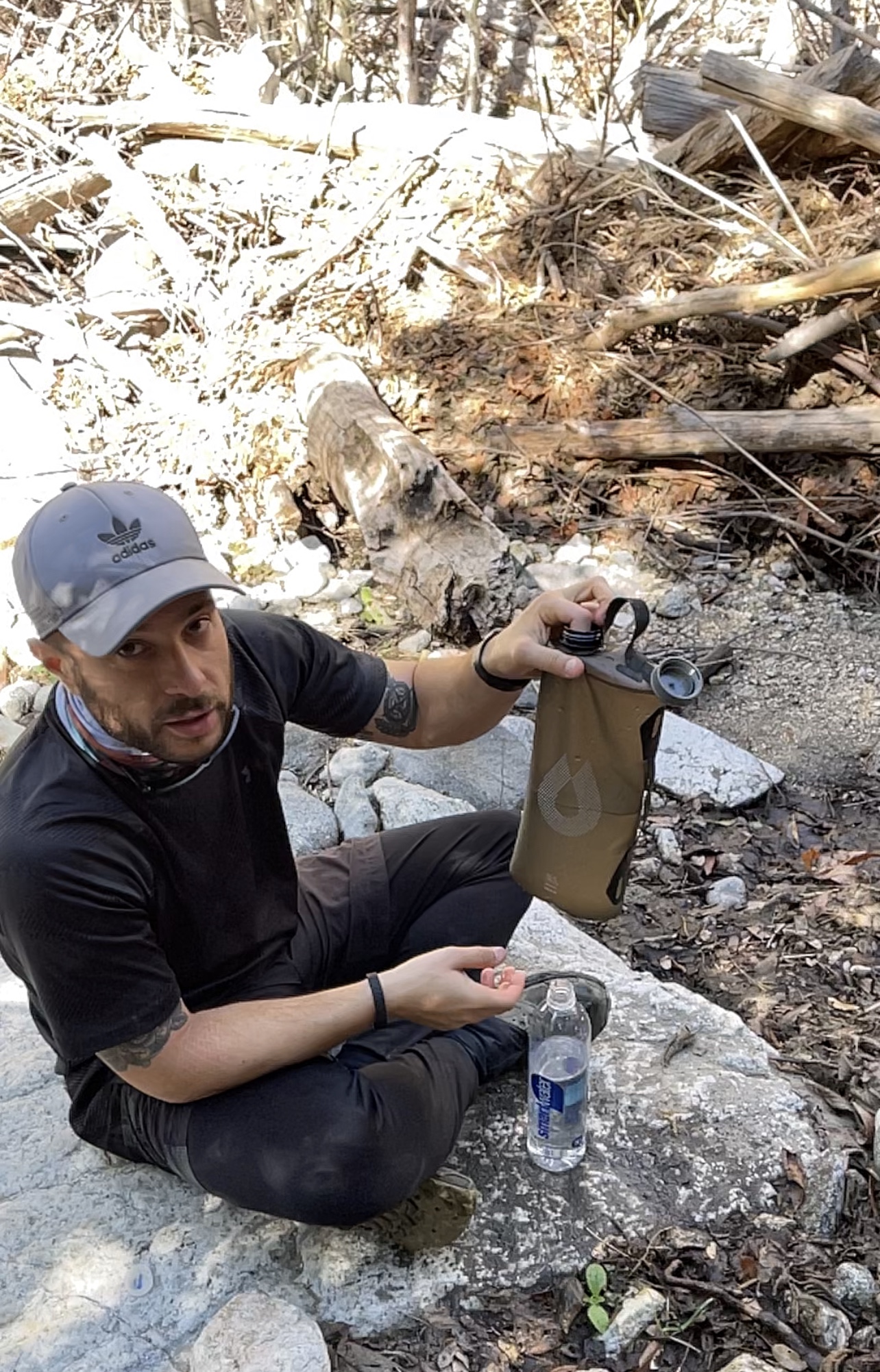
Next morning was just as fabulous of a day. We took our time packing up, filtering water, and enjoying a hearty breakfast of Clif Bars and fruit before slinging the pack up on our back and returning to that crazy, anxious, busy world, but of course we stopped to enjoy the views along the way and sniff the wildflowers. Oh, and pick the tick’s off of our Trail Mascot, Frank, the cute little dog of Joey’s. Later that evening as we exchanged information and pictures electronically I discovered that Frank was not the only victim of those little varmints, but that is a story for a future post on ‘Pursing Balance Through Adventure’ Backpacking and Hiking 101.
This outing in nature was super. Good trip, good spot, good camp, good trail, good fun, good guys, good ghost story, even good after party at a cool LA Eatery to celebrate- outdoors of course… COVID Protocol after all.
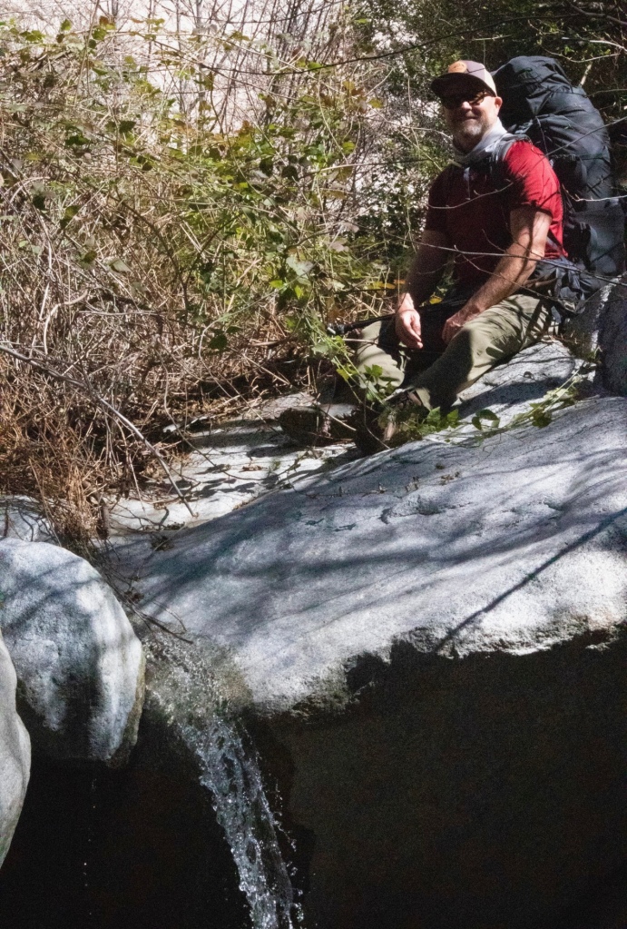
Photo by AnthonyEKing.com
Joey relaxes on a log dangling over a pool while on a trail break.
Ahmed lets me try out his hammock. Photo by AnthonyEKing.com
Photo by AnthonyEKing.com
There is nothing like a campfire to warm the heart, and to make your hands toasty.
Photo by AnthonyEKing.com Joey and his four legged faithful companion “Frank” cast eyes over the canyon.Our intrepid gang of explorers. Photo by Joey“A perfect gift for anyone that loves the outdoors is inviting them on an adventure.” – Ben StookesberryPhoto by AnthonyEKing.com
Thanks for joining Anthony, Grant, Ahmed, Joey, and I while ‘Pursing Balance Through Adventure’ in the Angeles National Forest along the Gabrielino Trail. Bear Camp was a great place to take a load off and unwind from the all the trappings of a nearby major city. It is hard to believe that just over the hill there are “30 Million People Surrounding US” when you are in a place so peaceful and remote. We wish the Through Hikers all the best with hopes that they truly find what they are looking for along the trail. I hope that I might meet up with them on some portion of their journey to at least experience a taste of such extreme adventure. Stay with us for more trekking by doing a couple easy tasks: LIKE, COMMENT, FOLLOW and SHARE. Then if you will checkout my Online SHOP APPARELfor top quality adventure wear that carries the mantra, the banner, the message, the logo: ‘Pursuing Balance Through Adventure’. That is what it is all about Profound Experiences in Nature to Balance home/work life with finding yourself, peace and harmony. You can get inspired to do just that and find your own adventure by checking out the menu for places that you might want to experience for yourself. Keep in mind that each location is a separate website and thus needs to be FOLLOWED independently.
This lovely area is closed until Spring of 2022 due to the Bobcat Fire. What a shame that wildfire ravaged this special place.
First off you need to have an Adventure Pass for Parking. That could be a $5 dollar day pass or an annual pass. While it is possible to buy one at a shop at the parking area that shop was closed on the day I was there, so I suggest buying one before you drive all the way up the mountain. They are for sale at the Arco Station at Santa Anita Ave and E. Foothill Blvd.
I loved the area and Sturtevant Falls, fantastic day hike! I was there on a Thursday before noon. I got one of the last parking spaces so be aware that this is a popular hike.
The area was very lush and lovely. It had rained the day before and it was very fragrant, a deep, damp, dank, musty, earthy smell of the forest was wonderful and made me believe I was truly on an adventure.
On the way to Sturtevant Falls there were cabins along the way. They were not in use, but they were not old and dilapidated either. They just seemed to be secure. Turns out, I suppose, they rent these cabins. Although the cabins were quaint and you almost expected to meet Hantzel and Gretel, to me this took away from my want of a wilderness area.
You will make multiple crossings of the flowing stream. You can maneuver rocks or logs, or even branches to get across to the other side. But be advised the rocks and branches can move as you step on them, but then again it is all part of the adventure.
When you see the falls you will instantly find a smile on your face from ear to ear. It is a beautiful, charming place.
After enjoying a snack and the gorgeous setting it is time to back track until you get to the trail heading to Hermit Falls.
There is more wonderful wooded areas. Across a meadow clearing, and along a stream, more crossings, and then finally you will find yourself on a trail that is basically cut into the rock dirt mountain. It has a steep, as in straight down, drop off so this portion of the trail is not for the faint of heart. If you have an issue with heights this may not be the hike for you. So the area is beautiful and wonderful, however the falls itself has been ruined by extensive tagging. So I cannot recommend Hermit Falls. It would have been pretty cool, but now not so much… It is a rock scramble sort of place. What are gangbangers doing in nature anyway? Why can’t they just stay in the inner city?
Once you get away from the spray painted Hermit Falls you are back into beautiful nature and it is a nice hike out.
Those of us who love this life will continue to want to put our skills, our nerve, our mental and physical endurance against harsh environments.Waterfall
Gentle murmurs caught in whispering winds quietly flows Gathering momentum in soft sunlight through willow trees A cool meandering transparent watery bliss that grows
Over the precipice their curtain hangs moving with ease Forming eddies whose chorus sings nature’s sweet song A mild turbulence of frothy spray rising in a cool breeze
Spreading to either bank rings of bright water flow along This beautiful sight spread before my deep pensive eye This image to remain in my heart so incredibly strong
Where kingfishers live alone in the banks dive and try To catch confused minnows caught up in the rush Now it’s only a stream flowing along just a gentle sigh
A waterfall can be a foaming torrent or a quiet soft gush Its rich perspective is a reward that is so pleasantly plush
David Wood
Thank for joining me while I found myself ‘Pursuing Balance Through Adventure’ in the Angeles National Forest chasing waterfalls. There are always more paths to explore, peaks to summit, streams to dangle your feet in so come along by doing the simple tasks of COMMENT, FOLLOW, SHARE and LIKE. If you go to the menu above you will find many wonderful spots in which to stretch your legs, fill your lungs with fresh air, and set your imagination soaring as you ponder some exploration of your own. Each is a separate website and thus needs to be FOLLOWED independently. To outfit yourself in adventure style and comfort go toSHOP APPARELwhere you can shop to heart’s content for top quality gear with a lifestyle mantra to boot.
7 miles, 1,300 elevation gain, 4 hours, rated Moderate.
Date: 8-12-20
The Burkhart Trail begins in the Buckhorn Campground, which looks like a nice place to car camp if you are so inclined. Another way to access this hike could be Cloudburst. Cloudburst does not require an Adventure Pass or America the Beautiful National Parks Pass, however Buckhorn Campground Trailhead does.
I started my adventure to the falls around 8 AM and it was about 60 degrees and by the time I finished, around noon, the temperature was in the low 80’s but down the hill well into the mid to upper 90’s. So it was nice to be in the mountains on this Summer day.
The trail descends through a wooded canyon with a babbling brook down below. There are even some beautiful Red Wood trees, which is not a common site in this area.
Once you pass the fork between Burkhart Trail and the PCT the Falls are just a few hundred yards more. It is not marked so you will just have to keep an eye peeled for a scramble going down. There is a rope to aid you going down a steep section to the water.
The falls are about thirty feet tall, pretty and serene. Cooper Canyon Falls flow pretty much most of the year, however in the Spring is when it will be at it’s max. The little pool below the falls is cool and refreshing, and a perfect place to unwind and relax.
I added on a short hike to Cooper Canyon Trail Camp, which would be a good spot for camping for the first time backpacker or as part of a longer exploration. The Pacific Crest Trail runs through this area, and I also saw a marker regarding the Silver Moccasin Trial that I thought sounded interesting. A side trip from this campsite could be Winston Peak.
There was a pretty good amount of people on the trail for mid week, but not to bad. I hear that Cooper Canyon Trail is crowded on the weekends. There were only a couple car spots left when I finished the hike before noon, so if you do this hike you will want to plan accordingly.
Take note that during August there are bugs, the little black flies are a nuisance. My ‘Pursuing Balance Through Adventure’ face gaiter had another beneficial use besides protection from sun, wind, and in this day and age the pandemic, but this time to ward off the little black flies from my face. As far as being responsible, most people were wearing masks and being respectful of physical distancing due to Covid-19.
Burkhart Trail to Cooper Canyon Falls was a great hike unfortunately my understanding is that this area is now CLOSED due to the 2020 Bob Cat Fire, so sad. It burned just a few weeks after I was there.
If you can’t be there in person than at least view a waterfall in motion.
“There is a waterfall in every dream. Cool and crystal clear, it falls gently on the sleeper, cleansing the mind and soothing the soul.” – Virginia Alison
Once again I found myself chasing waterfalls which is a perfect thing when you are ‘Pursuing Balance Through Adventure’. This was a lovely spot and a nice escape from the Summer heat. Please take a moment to COMMENT, LIKE, FOLLOW and SHARE which is the best way to explore a counterbalance between work life and freeing one’s soul in nature during exciting and bold experiences. Not everyone has the freedom to strap on a backpack and climb a mountain, ford a stream, or explore a canyon because of commitments or limitations, no worries because I will take you with me through my pictures, videos, and stories as together we are “Pursuing Balance Through Adventure”. If you can’t lace up your hiking boots then lace up your virtual boots because we are going on Safari! Checkout the menu above for more inspiration. Each location is a separate website and thus needs to be FOLLOWED independently. SHOP APPARELis your place for top quality adventure wear.
Strawberry Peak in the Angeles National Forest is part of the Six Pack of Peaks Challenge, thus making it a popular hike in LA County. It’s claim to fame is it is the tallest mountain in the front San Gabriel Range. You can forget searching for wild strawberries during the hike as it get’s it’s name from the shape of the sweet succulent berry and nothing more.
I suggest an early start as the only shade you will experience is a little tree line portion of the trail at the beginning and then just the shadow of the mountain. Bring plenty of water. On my summer hike I polished off 2.5L and started in on my reserve bottle for the over four hour trip.
The first half of the trek is a moderate, steady incline on a narrow trail etched into the side of Lawlor Mountain. Along the path are wonderful ever changing views, as it wraps it’s way around the Mountain on the way to the Lawlor Saddle. Once you make the saddle you have earned views now in the other direction.
From the Lawlor Saddle the Hard portion of the hike kicks in as it continues to steepen through sage, yucca and other coastal chaparral. There is no real scrambling involved with this journey to the summit, but you may need to boost yourself up in a couple places.
There is more than one false top so don’t get disappointed. It’s all part of the experience as you travel up and down along a portion of the ridge. But when you do summit you will have ”Sweet”, as in strawberry sweet, views in all directions of Pasadena, Los Angeles, and the San Gabriel Mountains all around.
Strawberry PeakThere is some rough trail near the top.Mt Wilson with the Observatory and the radio towers in the background along with Mount Disappointment, and the San Gabriel Peak. In the foreground is Mount Lawlor and it’s Saddle. There were portions of the trail that were nerve racking just to walk on. Hats off to this mountain biker.Those of us who love this life will continue to want to put our skills, our nerve, our mental and physical endurance against harsh environments.When Life Gives You Mountains Put On Your Boots And Hike
I am sad to report that at the end of the Summer the CA Fires swept through this area. The Bob Cat Fire burned right down to the parking area, and while I believe that most of this trail is in tact some of the views, I am afraid, have drastically changed. As of the writing of this post, (Mid Oct 2020), this area and the roads that lead to them remain closed.
I appreciate you joining me on this journey to the summit of Strawberry Peak while ‘Pursuing Balance Through Adventure. Please COMMENT, LIKE, FOLLOW and SHARE. The menu above links you to the different areas that PBTA travels. I am sure you will discover some grand adventures to put on your To Do list. While planning for said adventures you will need proper gear, so check out SHOP APPAREL, for top quality high performance gear, or maybe just a T-Shirt with a cool design, and a phrase to live by.
Free PBTA T-Shirt Drawing Celebrating 1000+ Followers on my different social media ‘Pursuing Balance Through Adventure’ platforms: Blogs – Instagram – Pinterest – YouTube – Facebook. THANK YOU Supporters!! How to Win a PBTA T-Shirt: Free Drawing to be announced Thanksgiving 2020. Each of the following gains an entry:
1.) Leave a COMMENT on any PBTA Social Media Platform Post.